Distance: 3.5 miles
Terrain: Hilly, with some unsealed footpaths; ground can be muddy
Start and finish: Mill Hill East Tube station
Species of bird seen: 14
This attractive circular north London walk takes in the heights of 'Mill Hill village', and presents you with views of the surrounding area as well as a stretch along a disused railway line.
We start and end at Mill Hill East, located on one of the northern branches of the Northern line (outside of peak hours, you’ll need to change at Finchley Central). The station building actually predates the Northern line, having originally been part of an older railway line — of which more shortly.
On leaving the station, turn left on the main road and then turn left again onto Sanders Lane. When the housing peters out we approach a bridge. Rather than cross it, follow the path to the right that runs down to the footpath that begins below the bridge.

This path follows the route of the old railway line from Mill Hill East to Edgware; this was part of a branch line between Edgware and Finsbury Park that was meant to be incorporated into the London Underground system in the 1930s but this was only partly done when war broke out (the stretch from Finchley to Mill Hill East was only completed because of the latter’s proximity to an Army barracks). Afterwards, plans to make the rest of the line part of the tube were scrapped.
Today, this stretch is the Copthall Railway Walk, a nature reserve running for just under a mile of the old line. Trees and birdsong abound as we pass under a road bridge (part of which appears to be used as a roost for pigeons). Further on are some local sports facilities; to our left are the Copthall swimming pools (Allianz Park is beyond), while five-a-side pitches are to our right.
The railway part of the walk ends with a blocked-up subway (beyond this, the route of the old line has had housing built over it). To continue on our walk, ascend the slope to the right and follow Page Street, past the private hospital and the mini-roundabouts. The road climbs as we come to a T-junction; just to the left of this is a footpath that climbs through trees.

This is Arrandene Open Space, another local nature reserve consisting of pasture divided by ancient hedgerows. We continue straight along the path, which can get quite muddy, crossing a track and eventually coming to a sign that tells us that we’re on private land owned by Mill Hill School — although the footpath is a public right of way.

Mill Hill School was founded in the early 19th century by non-conformists who wanted their school in rural surroundings, away from the dangers of London. The footpath through the grounds takes us between the cricket and rugby pitches, with views to the south east on our right (can you spot the top of the Shard poking over the horizon?).
The path emerges on a private road which has school buildings on it; turning right and following this up brings us to the heart if Mill Hill Village, one of three distinct areas that make up Mill Hill (the other two are the suburban areas around the stations at Mill Hill Broadway and Mill Hill East).
Points of interest to our left are School House (the school’s main building) and St Paul’s Church, built by the politician and anti-slavery campaigner William Wilberforce who moved to the area in the 1820s (although the church itself was not consecrated until shortly after his death in 1833).

We, though, are turning right, passing the duck pond while noting that the area’s religious associations — one of the cottages has a blue plaque stating that it used to be a Quaker meeting house — are still very much present.
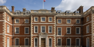
The old Methodist chapel is now used by an African church, and although the Missionary Institute’s old premises are now in the process of being developed for housing there remains a Catholic convent (the British headquarters of the Daughters of Charity) and a Jehovah’s Witness centre. The largest building in the area, though, is the copper-roofed National Institute for Medical Research which, by virtue of its hilltop location, is something of a local landmark.

Walkers interested in some refreshment at this point will be pleased to learn that shortly after the research institute is a pub, the Adam & Eve.
Not long after the pub, you’ll see a sign on the right indicating a footpath to Rushden Gardens. Follow that, walking downhill and pass an open field on the right which gives good views to the south west; the arch of Wembley Stadium is hard to miss but you should also be able to spot the spire of St Mary’s, Harrow on the Hill, on the horizon.
At the end of the footpath, follow the one immediately to the left — this will bring us to the suburban back street of Engel Park. Turn left, following the road up the hill until the junction with Bittacy Rise which we follow until we come to a footpath between two houses. Taking this path brings us into Bittacy Hill Park which has views to the south east.

At the bottom of the park, we’re back on Sanders Lane close to where we started. Turn left and head for the main road; Mill Hill East station is to the right.